

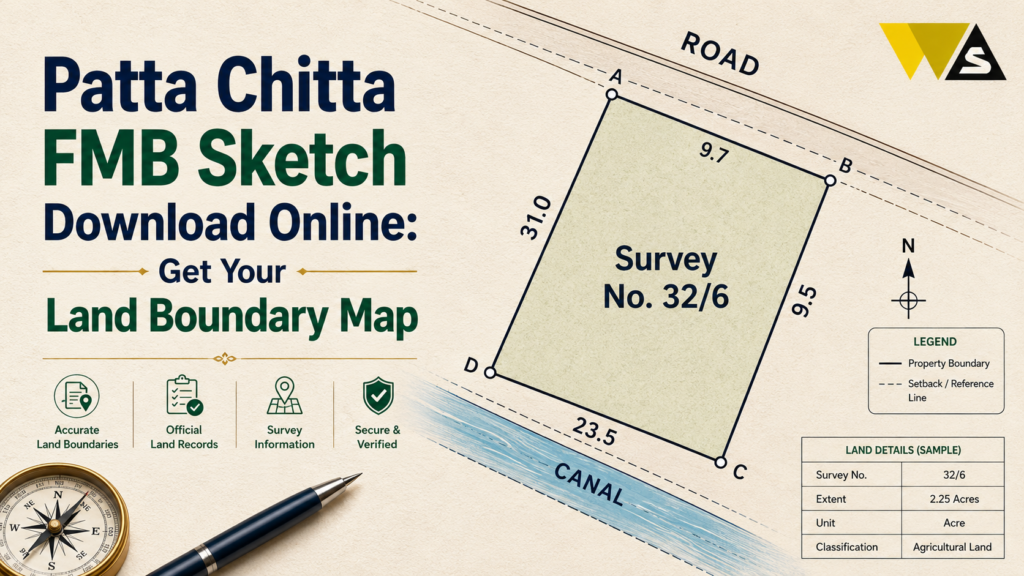
To download your FMB sketch (the land boundary map), go to the Tamil Nadu land records portal eservices.tn.gov.in , click “View Patta & FMB / Chitta / TSLR Extract”, select the area type (Rural / Natham / Urban), choose your District, Taluk, and Village, enter your Survey Number and Sub-Division Number, verify with the OTP/captcha, and download the PDF — for free.
The FMB (Field Measurement Book) is the official survey sketch that shows a plot’s exact boundaries, measurements, sub-divisions, and neighbouring survey numbers. Important: the online FMB is for reference only for bank loans, building/DTCP approval, or registration, you need the certified FMB copy from the Taluk Office (fee about ₹100–₹500). Patta shows who owns the land; FMB shows what the land looks like you need both.
Table of Contents
ToggleWhat is an FMB Sketch?
FMB stands for Field Measurement Book. It is the official survey sketch (map) of a piece of land, maintained by the Tamil Nadu Survey and Settlement Department.
While the Patta tells you who owns the land, the FMB shows what the land actually looks like — its exact shape, boundaries, and measurements. Think of it as the map of your plot.
What an FMB sketch shows:
- The survey number and its sub-divisions
- The boundaries (F-lines) of the plot
- The measurements of each side (in metres, chains, or links)
- The shape of the land
- The neighbouring survey numbers (adjacent plots)
- The total area/extent of the parcel
The FMB is the legal reference for boundaries. It is essential for buying land, settling boundary disputes, dividing land, building approval, and bank loans.
FMB Sketch Download Overview 2026
| Detail | Information |
| FMB Full Form | Field Measurement Book |
| What it shows | Land boundaries, measurements, sub-divisions |
| Maintained by | Survey & Settlement Department, Tamil Nadu |
| Portal | eservices.tn.gov.in |
| Path | View Patta & FMB / Chitta / TSLR Extract |
| Search by | Survey Number + Sub-Division |
| Area types | Rural / Natham / Urban (TSLR) |
| Online copy | Free — for reference only |
| Certified copy | Taluk Office, about ₹100–₹500 |
| Login needed? | No |
FMB vs Patta vs Chitta: What is the Difference?
Here is the simple difference:
- Patta: Shows land ownership — the owner’s name and Patta number.
- Chitta: Shows land classification (Nanjai/wetland or Punjai/dryland) and revenue details.
- FMB (Field Measurement Book): Shows the boundaries, shape, and measurements of the plot of the map.
In one line:
- Patta = who owns it.
- Chitta = what type of land it is.
- FMB = what it looks like and its exact boundaries.
Why you need all three:
When buying land, the Patta confirms ownership, the Chitta confirms the land type, and the FMB confirms the boundaries match the sale deed. A mismatch between the FMB and the deed is a leading cause of land disputes.
How to Download FMB Sketch Online (Step-by-Step)
Here is the simple, free process:
Step 1: Go to the official portal eservices.tn.gov.in .
Step 2: Choose your language (English or Tamil).
Step 3: Click “View Patta & FMB / Chitta / TSLR Extract”.
Step 4: Select the area type — Rural, Natham, or Urban.
Step 5: Choose your District, then Taluk and Village (or town/ward/block for urban).
Step 6: Enter your Survey Number and the Sub-Division Number (for example, 47/2).
Step 7: Enter your mobile number, then the OTP and captcha.
Step 8: Click Submit — the FMB sketch appears as a survey diagram with boundaries and measurements.
Step 9: Click “Download” / “Print” to save the PDF — free of cost.
How to Download FMB for Rural, Natham, and Urban Land
The area type you choose matters:
- Rural FMB: For agricultural/village land. Select Rural, then district → taluk → village → survey number.
- Natham FMB: For house plots inside a village settlement. Select Natham, then the settlement details and survey number.
- Urban (TSLR): For town/city plots, the boundary sketch comes through the TSLR (Town Survey Land Register). Select Urban, then district → town → ward → block → survey number.
Simple guide:
- Farmland → Rural FMB
- Village house plot → Natham FMB
- Town/city plot → Urban / TSLR sketch
How to Read Your FMB Sketch
An FMB sketch can look like a maze of lines and numbers, but it is simple once you know the parts:
- Survey number & sub-division: Written on the sketch confirms which plot it is.
- F-line (boundary line): The outer boundary of the plot, the main survey line.
- Measurements: Numbers along each side show the length of that boundary (in metres, or older chains/links).
- Shape: The overall shape of your land (rectangle, irregular, etc.).
- Neighbouring survey numbers: The adjacent plot numbers are marked around your plot useful for locating and cross-checking.
- Sub-division lines: If the plot is split, internal lines show the sub-divisions.
Match the shape, boundary lengths, and neighbours on the FMB with the sale deed schedule and the actual land on the ground. They should all agree.
Online FMB vs Certified FMB
- Online FMB (from the portal): Free, instant, and good for reference and personal checking but it is NOT a certified/legal copy.
- Certified FMB (from the Taluk Office): A stamped, official copy from the Tahsildar/Taluk Office, with a fee (about ₹100–₹500). This is the copy that holds legal weight.
When you need the certified copy:
- Bank loans against the land
- DTCP / layout / plan approval
- Building permits
- Property registration
- Land sub-division
- Court / dispute matters
How to Get a Certified FMB Copy (Offline)
If you need the certified FMB, here is how to get it:
- Visit your Taluk Office (Tahsildar) or the Survey Department office.
- Submit an application with your Survey Number, Sub-Division, and village details.
- Attach copies of your Patta and ID proof.
- Pay the fee (about ₹100–₹500, depending on the district and plot size).
- Collect the certified FMB sketch (stamped and signed).
Why You Need an FMB Sketch
The FMB is essential in many situations:
- Buying land — confirm the boundaries and area match the deed and the ground.
- Selling land — shows buyers the exact plot boundaries.
- Boundary disputes — the FMB is the official reference for the correct boundary.
- Dividing land (sub-division) — needed to split a plot correctly.
- Building approval / DTCP — required for plan and layout approval.
- Bank loans — banks ask for the FMB to confirm the plot.
- Encroachment check — confirm no one has crossed your boundary.
What to Do if FMB Sketch is Not Downloading
Sometimes the FMB does not show. Common reasons and fixes:
- Wrong survey/sub-division number: Re-check the exact number (including the subdivision).
- Wrong area type: Try Rural, Natham, or Urban pick the correct one.
- Wrong village/taluk: Confirm the correct revenue village and taluk.
- Village not digitised: Not all villages have digitised FMBs yet visit the Taluk Office.
- Re-survey change: The survey number may have changed to get the new number from the VAO.
- OTP/captcha/browser issue: Refresh the captcha, re-check your mobile, or try a different browser.
Common Mistakes to Avoid
- Treating the online FMB as a legal copy — it is reference only; get the certified copy for official use.
- Not matching the FMB with the sale deed — a mismatch signals a problem.
- Ignoring the sub-division — confirm the seller’s sub-division matches the FMB.
- Not checking neighbours — the adjacent survey numbers help confirm the right plot.
- Skipping a ground check — the FMB should match the actual land boundaries.
- Relying on FMB alone — also check Patta Chitta, and EC before buying.
Conclusion
The FMB sketch (Field Measurement Book) is your land’s official boundary map — it shows the exact shape, measurements, sub-divisions, and neighbouring plots of a survey number. You can download it free on eservices.tn.gov.in by clicking “View Patta & FMB / Chitta / TSLR Extract”, selecting the area type (Rural/Natham/Urban), entering your district, taluk, village, and survey/sub-division number, verifying with OTP, and saving the PDF.
The online FMB is for reference only for bank loans, DTCP/building approval, registration, or disputes; you need the certified FMB copy from the Taluk Office (fee about ₹100–₹500). And always remember the difference: Patta shows who owns the land, while the FMB shows what the land looks like for any land deal, check both, plus the Chitta and EC, and match the FMB with the actual ground.
Download your free FMB to check boundaries anytime, get the certified copy when you need it officially, and you will protect yourself from boundary disputes, encroachment, and land fraud.
Frequently Asked Questions (FAQs)
1. What is an FMB sketch?
FMB stands for Field Measurement Book. It is the official survey sketch of a land parcel, maintained by the Tamil Nadu Survey and Settlement Department, showing the plot’s exact boundaries, measurements, sub-divisions, and neighbouring survey numbers. It shows what the land looks like, not who owns it.
2. How do I download an FMB sketch online?
Go to eservices.tn.gov.in, click “View Patta & FMB / Chitta / TSLR Extract”, select the area type (Rural/Natham/Urban), choose your district, taluk, and village, enter the survey and sub-division number, verify with OTP and captcha, and download the PDF for free.
3. Is the FMB sketch download free?
Yes. You can view and download the FMB sketch online for free without logging in. For a certified copy, visit the Taluk Office and pay the applicable fee.
4. What is the difference between the online FMB and the certified FMB?
The online FMB is free and good for personal checking, but it is not a legal document. The certified FMB, obtained from the Taluk Office with a small fee, is stamped and holds legal weight — needed for bank loans, DTCP/building approval, registration, and disputes.
5. What is the difference between FMB and Patta?
Patta shows land ownership — the owner’s name and Patta number. FMB shows the land’s boundaries, shape, and measurements — the map of the plot. Patta answers “who owns it”, while FMB answers “what does it look like”. You need both for a land deal.
6. How do I read an FMB sketch?
Look at the survey number and sub-division, the F-line (outer boundary), the measurements along each side (metres/chains/links), the overall shape, and the neighbouring survey numbers marked around the plot. Match these with your sale deed and the actual land on the ground.
7. Can I download an FMB for a house plot or city property?
Yes. For a house plot inside a village, choose the Natham option. For town or city property, the boundary sketch comes through the TSLR (Town Survey Land Register) under the Urban option. Farmland uses the Rural FMB.
8. Why is my FMB sketch not downloading?
The survey or sub-division number may be wrong, the area type or village may be incorrect, the survey number may have changed after a re-survey, or the village may not be digitised yet. Re-check the details, or visit the Taluk Office for un-digitised records.
9. When do I need an FMB sketch?
You need it for buying or selling land, boundary disputes, dividing land, DTCP/building approval, bank loans, and checking for encroachment. Whenever the exact land and its boundaries matter — not just ownership — the FMB is essential.
10. Is the FMB sketch enough to buy land safely?
No. FMB shows the boundaries, but it is not enough by itself. Check Patta, Chitta, and EC too, and compare the FMB with the actual land before buying.
Read our article:
Read our article:
Read our article:
Read our article: